Mountains Below the Confluence
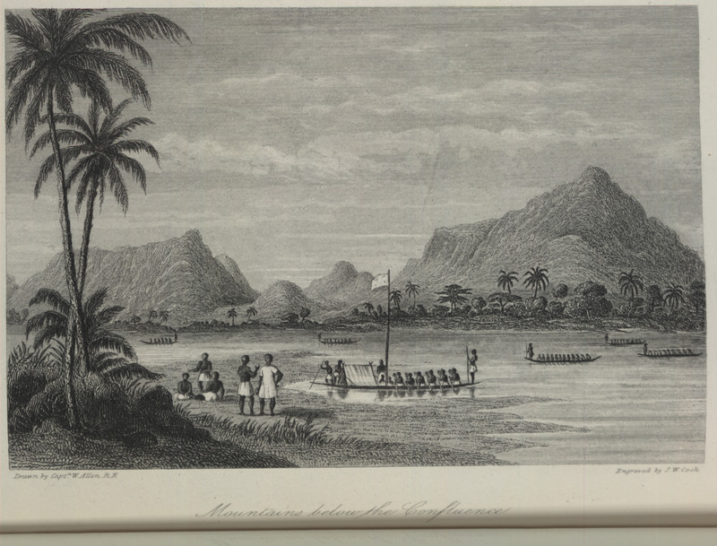
This engraving shows long canoes on the Niger river, below its confluence with the Benue River (also known as the Chadda or Chaddah River in historical sources) in the Bight of Biafra hinterland. In a contemporary map published in the 1830s, the mountains depicted in this image might reflect "King William's Range," which obviously had no association to Africa's geography. Today, this mountain might be Aporo Hill to the north of Idah in the kingdom of Igala. William Allen (1792–1864) was an English naval officer and explorer. Thomas Richard Heywood Thomson (1813–1876) was an English explorer and naturalist. They took part in the Niger expedition to map the course of the river. In Cape Coast, Allen and Thomson interacted with the Fante king, Joseph Aggrey Essien (1809–1869).
Image Title
Mountains Below the Confluence
RegID
SI-OB-855
Date
1848
Title
Mountains Below the Confluence
Source
William Allen and Thomas Richard Heywood Thomson, A Narrative of the Expedition sent by Her Majesty's Government to the River Niger, in 1841, vol. 1 (London: R. Bentley, 1848), p. 333.
Language
English
Item sets
Pre-Colonial Africa: Society, Polity, Culture
Spatial Coverage
Africa--Eastern Bight--Aporo Hill
Researchers
Jerome Handler; Michael Tuite; Henry B. Lovejoy Graduate Research Assistants: Tiffany Beebe; Travis May
Last Updated
10-Feb-17; 27-Aug-19
Identifier
Allen06