Plan of the Island of Gorée
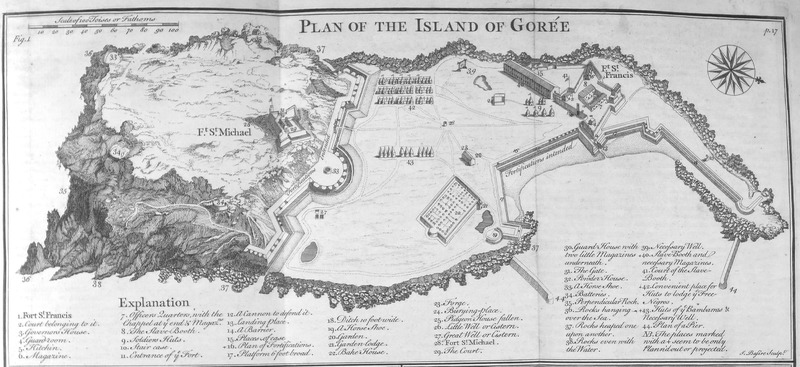
This engraving is a British diagram laying out the defences and organization of the French slave-trading island of Gorée, including sketches of forts labelled St. Michael and St. Francis. Other numbers identify locations of more buildings and points of reference. Thomas Astley (d. 1759) was a British bookseller and publisher who never went to Africa. His imagined localities and illustrations of Africa were informed by a library of travel books at his disposal.
Image Title
Plan of the Island of Gorée
RegID
SI-OB-806
Date
1745-1747
Title
Plan of the Island of Gorée
Source
"Plate X" in Thomas Astley (ed.), A New General Collection of Voyages and Travels, vol. 2 (London: Thomas Astley, 1745-1747), facing p. 18.
Language
French
Item sets
European Forts & Trading Posts in Africa
Spatial Coverage
Africa--Western Savanna--Gorée
Reproduced In
See similar views "Plate 3" in Awnsham Churchill and John Churchill, A Collection of Voyages, vol. 5 (London: Printed for Awnsham and John Churchill, 1732), p. 21. For a view of Gorée from the sea in 1681, see P. E. H. Hair, Adam Jones and Robin Law, Barbot on Guinea, 1678-1712, vol. 1 (London: Hakluyt Society, 1992), 41.
Researchers
Jerome Handler; Michael Tuite; Henry B. Lovejoy Graduate Research Assistants: Tiffany Beebe; Travis May
Last Updated
1-Feb-17; 21-Aug-19
Identifier
Astley001