Plantation Yard and Slave Village, Jamaica, 1758
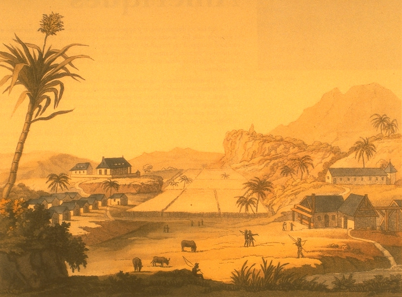
Shows Parnassas Estate, Clarendon parish. Slave houses on left, sugar works on right; owner/manager's house in upper right. (slide of image, courtesy of Barry W. Higman).
Image Title
Plantation Yard and Slave Village, Jamaica, 1758
RegID
SI-OB-497
Date
1758
Title
Plantation Yard and Slave Village, Jamaica, 1758
Source
Published in Barry W. Higman, Jamaica surveyed: plantation maps and plans of the eighteenth and nineteenth centuries (Institute of Jamaica Publications Ltd., 1988), fig. 4.13, pp. 95-9; original located in the National Library of Jamaica.
Language
English
Item sets
Plantation Scenes, Slave Settlements & Houses
Spatial Coverage
Caribbean--Jamaica
Reproduced In
Barry W. Higman, Jamaica surveyed: plantation maps and plans of the eighteenth and nineteenth centuries (Institute of Jamaica Publications Ltd., 1988), fig. 4.13, pp. 95-9
Researchers
Handler, Jerome; Tuite, Michael; Randall Ericson; Henry B. Lovejoy Graduate Research Assistants: Tiffany Beebe; Travis May
Identifier
NW0086