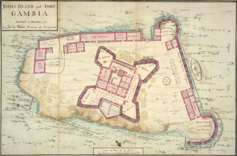
James Island and Fort Gambia, 1755

Surveyed in October 1755 by Justly Watson, Director of Engineers, this colored manuscript plan shows the fort, its storehouses, gun battery, quarters for European personnel, and, in the upper right, the quarters and yards where slaves were kept. Surrounding the central part of the fort on three sides, indicated by faint round circles, are the hutts for the castle slaves (left side) or Negros Hutts (right side and top). Another very clear architectural drawing of James Island and its fort was done in 1727 by William Smith, surveyor of the Royal African Company (see image mariners16 on this website ). Watson's drawing shows many more details and structures, indicating how the fort expanded between 1727 and 1755.
Image Title
James Island and Fort Gambia, 1755
RegID
SI-OB-104
Date
1755
Title
James Island and Fort Gambia, 1755
Source
The National Archives, London (formerly, Public Record Office), MPG 1/224; see Comments.
Language
English
Item sets
European Forts & Trading Posts in Africa
Spatial Coverage
Africa--Western Savanna
Researchers
Handler, Jerome; Tuite, Michael; Randall Ericson; Henry B. Lovejoy Graduate Research Assistants: Tiffany Beebe; Travis May
Last Updated
30-Mar-17
Identifier
PRO-1